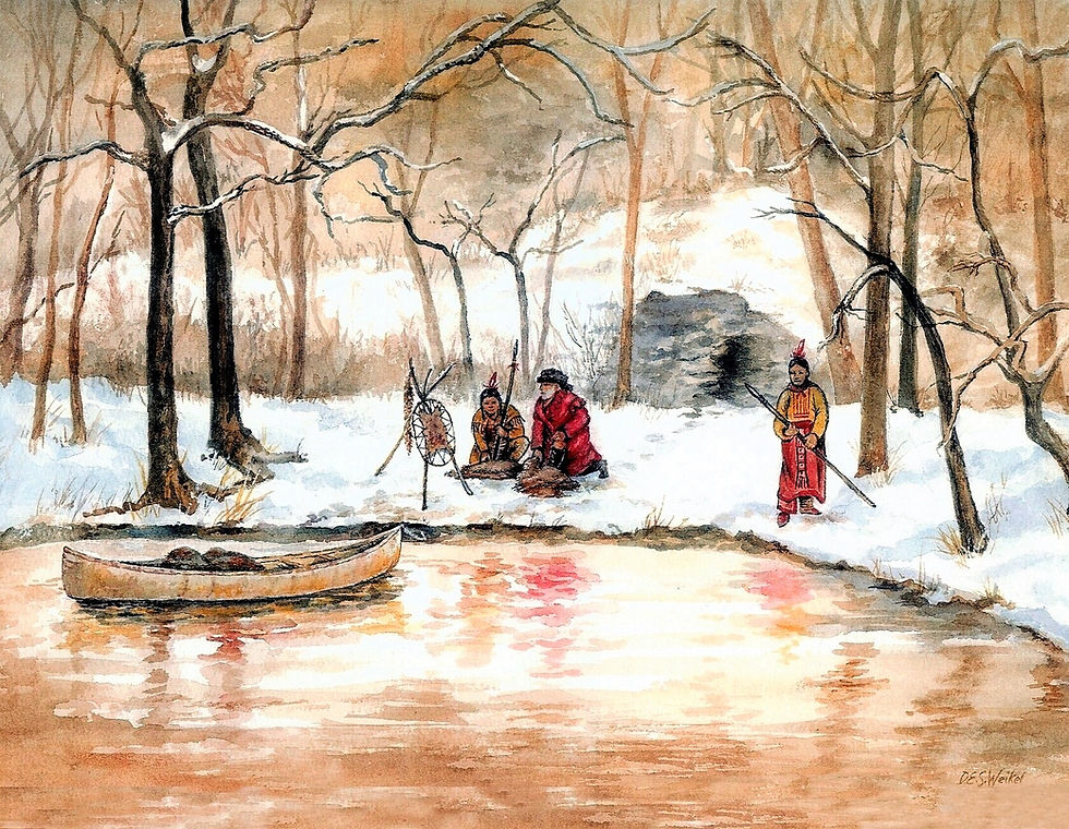
The Spring City Cave of Pierre Bezaillion
- WCB

- Feb 11, 2019
- 3 min read
Updated: Feb 14, 2019

Many years ago when I first started hanging around the local museum I would be intrigued by the number of people who stopped by asking about the old cave that was located here in Spring City. They wanted directions to the cave so they could explore it. Of course the problem was that the cave had not been located in recent times. The cave is correctly known as "Bezaillion's Cave".
Many of the oldtimers who frequented the station museum told stories about their exploration of the cave when they were boys. The accounts were numerous. The details were not always consistent but the underlying theme was always the same. They remembered the cave. In the early 1920’s these men would have been the young teenagers exploring that area along the mill pond where the cave would have been located.
The men, my friends; Lawrence Shaner, Elmer Grime and Dick Obenshine, have all passed away now and with them are the stories of the cave.
In 1700 the river forked into two paths with an island in the middle. The cave was located on the banks of the western run on what is now the Spring City side. That was 300 years ago and numerous changes have occurred that drastically changed the landscape of that area forever. The canal opened in 1824, the paper mill was completed in 1847 and the Pennsylvania railroad came through in 1884. Each one had an effect on the environment. The river was modified and the mill pond created as a result of these changes. It is the popular opinion of most experts that the cave was filled in during the construction of the canal. The modifications of the landscape when the Pennsylvania Railroad came through also caused much change as the back filling of the land created the mill pond and closed off the fork in the river.
Pierre Bezaillion was a French Canadian fur trapper who was known to have frequented this area. His local connection was of course the cave that was located in what is now Spring City. At the time (1687 - 1696) this area was a vast wilderness and Springville did not exist. The cave located near the river was in Vincent Township which was established in 1686. We are not sure who first discovered this cave (probably the local Lenni-Lenape Indians) but Pierre Bezaillion stayed there and used it for storing his furs and traps. He is generally credited with its discovery and on a 1773 map of Vincent Township the cave is clearly marked and labeled as Bazillion’s cave. An Indian map from 1700, published by the University of Pennsylvania in 1992, also shows the cave and identifies it as the “Fur Trapper’s Cavern”.
In 1700 the river forked into two paths with an island in the middle. The cave was located on the banks of the western run on what is now the Spring City side. That was 300 years ago and numerous changes have occurred that drastically changed the landscape of that area forever. The canal opened in 1824, the paper mill was completed in 1847 and the Pennsylvania railroad came through in 1884. Each one had an effect on the environment. The river was modified and the mill pond created as a result of these changes. It is the popular opnion of most experts that the cave was filled in during the construction of the canal. The modifications of the landscape when the Pennsylvania Railroad came through also caused much change as the back filling of the land created the mill pond and closed off the fork in the river.
So where exactly is the cave location today. Go up Bridge Street in Spring City to the Church Street intersection and turn right (north) towards the former entrance to Pennhurst, Then travel back a distance and look down over the big hill on your right. You will see some of what is left of the Mill Pond. This pond was once part of the river and 300 years ago a small cave was located on the river banks at this approximate location.
If you are interested in finding out more about Bezaillion and the history of this area you are invited to stop by the local museum located at 526 Main Street in Royersford.
WCB


Comments